It’s an oft-overlooked fact that the original British colonists who settled along the shores of the Ashley River in 1670 did not actually make their initial landing at Charles Towne. Malnourished and exhausted after a terrifying three-month transatlantic ordeal that blew them 60 miles north of an intended landing at Port Royal, the crew of the frigate “Carolina” first dropped anchor off the northern end of a foreboding island fronted by blinding white dunes and a wall of salt-sculpted oaks.
Rowing ashore in a March breeze, Captain Joseph West and crewmen Nicholas Carteret and Stephen Bull were met by a hunting party of friendly and civilized Indians whose skin was tinted a deep ochre from an insect-repelling compote of bear fat, bloodroot, and perhaps bay leaf. The natives were Sewee Indians, master hunters, fishermen, and canoe builders who spoke a few words of Spanish and called their island “Oniescau.” Despite the reciprocal friendliness of the explorers, tragedy lay ahead for the Sewee. Thinking England lay just beyond the horizon and wishing to trade directly with the English king, almost every able-bodied man and woman loaded their canoes with animal skins and rowed out to sea, where the little flotilla was hit by a hurricane. Those who did not drown were rescued by a ship and sold as slaves in the Caribbean. The remaining vestige of the tribe was extinct within 30 years. The original name of their beautiful island and adjacent bay were forgotten and named in honor of Bull.
Tying off a Carolina skiff on the backside of a still-primeval Bulls Island on a blustery Sunday afternoon, I can’t help but ponder the disappearance of the Sewee and wonder what they would have made of our landing party: eight Anglos armed not with muskets and swords, but cameras, bikes, and surfboards. And how astonished they might have been to see our crew—McClellanville chef, fisherman, and clam farmer “Pirate” Pete Kornack; local surf guru Glenn Tanner; retired S.C. Department of Natural Resources (SCDNR) biologist Foster Folsom; Shaka Surf School owner Jenny Brown and her husband, Chris; and Charleston Kayak Company owner Luke Pope-Corbett—all walking on water.
I learned to surf as a young teenager up the coast in Surfside Beach and quickly developed a lifelong addiction to the sport. Pilgrimages to Folly and Sullivan’s islands for big hurricane or northeasterly swells became part of the routine until, like several other hell-bent Carolina surfers, I left for the promised land of California. Yet even while living the dream of being a surf writer on the crowded West Coast, I harbored an enduring fascination with the surfing possibilities along the vast and uninhabited swath of shoals, sandbars, and islands from the Santee River Delta south to McClellanville, Bulls Bay, and beyond.
This fascination was historically appropriate, as the watery borderland between Georgetown and Charleston counties is the ancestral home of one of the least-known but most important surfers in history, Alexander Hume Ford. Born in 1868 to a family whose members owned Hopsewee and Ford’s Point plantations along the Santee River, Ford attended school at Charleston’s Porter Military Academy (today’s Porter Gaud) and did a brief stint as a reporter for the News and Courier before the massive earthquake of 1886 so unhinged him that he left for New York. There, he met up with old Charleston friend John C. Calhoun Jr. and worked as a journalist and playwright, even producing a rendition of Tom Sawyer for Mark Twain. When New York became too small, Ford set out for China and Russia, writing dispatches for some of the most influential magazines of his time, witnessing the building of the trans-Siberian railroad, and listening in horror as tigers dragged screaming construction workers to their fate in the dead of night. The irrepressible Charlestonian eventually settled in Honolulu, where he became fascinated by the 10 or so locals who denied the Puritanical decrees of their missionary overlords and clung to the sport of surfing. While Ford devoted his later years to the formation of a Pan-Pacific Union, he dedicated his middle age to the sport, befriending seminal surfers like George Freeth and Duke Kahanamoku and co-founding Waikiki’s Outrigger Canoe Club, which is still in existence today. It’s generally recognized that it was Hume Ford who saved the sport from oblivion. “Learn to ride a surfboard,” Ford told novelist Jack London during a visit to Hawaii. “It is the sport of kings.”
Alexander Hume Ford would surely be amazed to find that his disciples have spread across the earth and swarmed over Folly Pier and the Washout like sand gnats on a kayaker. He also would have recognized that when you surf amongst a crowd, the fundamental experience changes from freedom and solitude to a competition for scarce resources—hunting amidst a pack of feral dogs who are all equally hungry. That’s why historical explorations into our local aquatic wilderness have become an obsession for a few of my friends and me. With patience, resourcefulness, a knowledge of currents and sandbars, and sometimes a boat, we’ve found that Alexander Hume Ford’s homeland can offer the sort of solo, wilderness surf experience perhaps more akin to the Waikiki of a century ago.
These are not typically spots for beginner surfers, who are far better served at mellow breaks along the Isle of Palms or well south of the Folly Pier. The remote islands themselves—Cape, Raccoon Key, Bulls, Capers, and Botany—teem with mosquitoes, horseflies, snakes, and alligators. Even if the swells aren’t that big, tidal and wind-driven currents can shift on a dime, and the waters are rife with jellyfish, stingrays, and sharks. Your friends are the only lifeguards you have, and medical help is at best an hour away—sometimes considerably more. If you venture out to an interisland shoal during a hurricane swell, the stakes are even higher. It may be calm and glassy at the McClellanville landing, but how well do you trust your boat, and your captain, to navigate an afternoon cloudburst or the rapidly rising confluence of wind and swell?
Then consider the surfing itself. Lose your board at the Washout, even on a big day, and it’s an easy swim in to retrieve it. Slice your leg with your fin, and an ambulance is nearby. Not so in the waters of Price Inlet between Capers and Bulls islands or, say, Botany Island. If something goes wrong a half mile offshore while you’re already battling an outgoing tide with tired noodle-arms, the situation can instantly become life-threatening. During one trip to Cape Romain, my buddy Ryan Olsen wiped out right next to me. He surfaced screaming like a horror-movie victim, and I thought for sure he’d been hit by a tiger shark. He had instead fallen directly into the waiting arms of a big jellyfish. Had Ryan been allergic to the stings, he might have died. But then again, that’s what made it an adventure.
North of the Isle of Palms resides one of the Lowcountry’s most adventurous surfers, my friend “Pirate” Pete Kornack. I met Pete and his wife, Claudia, one day when my wife and I stumbled through the screen door of a funky, artifact-filled 19th-century general store-turned-restaurant in the mossy heart of McClellanville. I was surprised to find a surf video on the TV, a beautiful wooden surfboard on the wall, and fish tacos and a heavenly confection Claudia calls “Pawleys Island Pie” on the menu. Pete was an inveterate crabber, oysterman, explorer, and surfer who had earned his culinary arts degree at Johnson and Wales and, like me, had lived in Laguna Beach, California. Once in McClellanville, he started cooking for the lunch crowd at Mr. Graham’s store in exchange for a room out back, and eventually he and Claudia bought (and recently sold) the place. “Dude, there are some crazy waves along Cape Romain,” Pete told me. “I’ve gotten one ride out there that was better than 90 seconds long.”
Soon, Pete and I were motoring out of McClellanville’s Five Fathom Creek in search of surf. Our first real adventure came aboard the boat of an honest-to-God one-legged sea captain. We’ve been skunked and scared chasing hurricane swells around Cape Romain’s sandspits, but we’ve also had a couple of the more rewarding sessions of our lives, hooting each other and a handful of buddies into empty waves.
My other regular partner in crime is Luke Pope-Corbett. He and I began surfing together several years ago when he worked as a kayak guide and captain on Coastal Expedition’s Bulls Island Ferry—which will haul both bikes and surfboards. Today, Luke is the owner of Charleston Kayak Company and an outfitter for Middleton Place Plantation. He’s always looking for an excuse to fire up his Carolina skiff and motor off into the unknown or paddle across a fast-moving channel above unexploded cannonballs to surf in the shadow of a 150-year-old lighthouse.
Luke, Pete, and I had begun commiserating during a cold-front-driven storm a week earlier, when it was still delivering tornadoes to the Midwest. As the storm tracked east and dipped into Louisiana on a Saturday afternoon, it would inhale a massive plume of unstable Gulf air and develop into what’s known as a lee-side low, something akin to a late springtime tropical storm. By Sunday morning, the offshore waves would be pushing 10 feet and the low would then track north, flooding the northeast. Locally, the wind should shift to a favorable west-northwest direction, grooming the southeasterly swells into flawless overhead peaks. Our crew decided to surf a lesser-known Folly sandbar in the morning to catch “the sure thing” (which we did, subjecting photographer Peter Frank Edwards to a vicious offshore pummeling), and if conditions warranted, to then head to Oniescau to ride the incoming tide.
At Bulls Island, we unloaded bikes and boards in a driving rainstorm amidst a nostril-clogging cloud of sand gnats that somehow dodged the raindrops. Jenny and Chris Brown sprinted out ahead for the mile-and-a-half trek down Beach Road. En route, they startled a 10-foot alligator, nearly ran over a massive cottonmouth snake, and stumbled on a mature bald eagle feasting on the carcass of a common loon.
We were still a quarter-mile from the beach when we heard their hooting at the waves. They were breaking well offshore about head-high, smooth as polished glass with nary a drop of water out of place. Sitting out in the lineup a few minutes later, the rain abated. Glenn Tanner and Foster Folsom shook their heads in disbelief at the conditions and the fact that despite being lifelong local surfers, they had never surfed out here. “Think about it,” marveled Tanner. “We’re the only people on this whole island. There’s probably not another surfer for 20 miles to our south and 50 to our north.”
Just how I like it.
Dare & Prepare
The suggested locales for “wild surf” are not intended for novice surfers and many of them require skills in boating and navigation. If you’ve got what it takes, be sure to prepare thoroughly in advance for your surf expedition.
Gear Up
Pack bug spray, sunscreen, and a first-aid kit (including an EpiPen and Benadryl or other antihistamine for allergic reactions to bites or stings), as well as plenty of water and food. A tight-fitting rash guard or spring wet suit can do wonders in repelling the stings of jellyfish and even man-of-wars, and a big bottle of vinegar can help neutralize stings.
Boat Safety
If traveling by boat, be sure the equipment meets all of the state and federal safety requirements, including a personal floatation device (PFD) for each passenger. For more info, visit dnr.sc.gov/boating/safety.html.
Complete a float plan and give it to your emergency contact. While the U.S. Coast Guard and SCDNR do not accept filed float plans, you can download a free online form from the Boat Owners Association of the U.S. at boatus.com/seaworthy/floatplan.asp. The plan will contain all relevant data for the Coast Guard should you fail to return.
Make sure the boat’s VHF radio is working. The Coast Guard monitors Channel 16 for distress calls. For more info on calling the Coast Guard and emergency radio procedures, visit uscg.mil/pvs/docs/Brocures/MAYDAY.pdf. The Coast Guard Sector Charleston Command Center 24-hour line is (843) 740-7050.
Cape Island, Lighthouse Island, & Raccoon Key
(Part of the Cape Romain National Wildlife Refuge)
Best for experienced surfers
The surf: Cape Island works best on northeasterly to easterly swells and west to southwest winds. Southerly swells are blocked here by extensive shoals to the south. Anchor in the bay, near the south end of the island, and walk around the dunes to find your spot.
Lighthouse Island and Raccoon Key work best on southerly to southeasterly swells with northwest to north winds, while northeasterly swells are blocked by shoals. All these islands work best on incoming to high tides.
Dangers: Sharks, bugs, jellyfish, stingrays, and strong intertidal currents
If there’s no surf: Beachcomb, bird-watch, or go for a (careful) swim.
Local knowledge: Due to nesting birds, walking over the fragile dunes is generally forbidden and a terrible idea anyway. On summer days with calmer winds, the bugs out here can be ferocious. Stop in at T.W. Graham and Company for lunch or dinner in McClellanville on your way back to civilization.
Get there: You have three options: your own boat; a very long kayak paddle from McClellanville; or the Coastal Expeditions Ferry, if they’re offering a tour [coastalexpeditions.com, (843) 884-7684]. Check in with the Sewee Environmental Education Center to learn if any areas are off limits due to wildlife restrictions [fws.gov/seweecenter, (843) 928-3368].
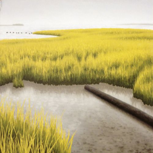
Bulls Island (Part of the Cape Romain National Wildlife Refuge)
Best for intermediate to experienced surfers
The surf: On the north end, go either to the west of Boneyard Beach, or well to the south of the Boneyard off Beach Road. The island breaks best on easterly to southerly swells with calm west to south winds and can offer long, peeling waves. The northwest end, past the Boneyard, is best rising to high tide; the south end is best on low-incoming tide.
Dangers: Sharks, bugs, jellyfish, stingrays, alligators, strong intertidal currents, and trees in the lineup near the Boneyard
If there’s no surf: Fish, beachcomb, bird-watch, go for a (careful) swim, or take a bike tour of the island.
Local knowledge: Due to sea turtle and bird nests, you are absolutely not allowed to ride your bike on the actual beach. Doing so could imperil everyone’s ability to ride the island in the future. The roads/trails can be fairly soft sand and hold sandspurs. Bring fat tires and a tube repair kit. Ride with particular caution around alligators.
Get there: The island is regularly served by Coastal Expeditions’ Bulls Island Ferry [coastalexpeditions.com, (843) 884-7684]. Boards and bikes may be taken on the ferry provided the crowds aren’t too heavy. Call ahead of time to confirm. You may also take your own kayak or boat from Garris Landing in Awendaw. If you do so, knowledge of the waterways and a good chart is a must, as the marsh route to Bulls Island is labyrinthine. Tie off on the backside of the island at the Fish and Wildlife Service wooden dock. (Do not tie off in the slips at the dock, as these are used by the FWS and Coastal Expeditions.) Bike to the north via Old Fort or Lighthouse roads or across the island on Beach Road from the dock. Or anchor securely on the backside of the northern sandbar and walk south towards the Boneyard. Note: this is not an exercise for the novice boater. Currents can be fierce during tidal changes.
Capers Island Heritage Preserve/
Price & Dewees Inlets
(South Carolina Department of Natural Resources [SCDNR] Protected Area)
Best for intermediate to experienced surfers
The surf: Capers has a tree-filled boneyard area at its southerly end that is somewhat like the one on Bulls Island. It’s best to surf well north of here. The sandbars around Price Inlet can be very good on east-to-southeasterly swells and west-to-northerly winds on low-incoming tides, hurricane swells in particular. It’s highly recommended that you travel out here for your first visit with Barrier Island Eco Tours [nature-tours.com, (843) 886-5000] or line up a private powerboat charter with Charleston Kayak Company [charlestonkayakcompany.com, (843) 628-2879].
Dangers: Sharks; jellyfish; stingrays; alligators; strong intertidal currents; and trees in the lineup at the Boneyard, particularly at high tide
If there’s no surf: Fish, beach-comb, bird-watch, go for a (careful) swim, or camp.
Local knowledge: Shifting sandbars and a good knowledge of local winds and currents can offer up excellent long waves—particularly left-handers at the cove inside of Price Inlet—on the right swells and wind. Bikes are not allowed on the beach or interior roads, which leaves you walking. Camping is allowed here by permit from the SCDNR [https://www.dnr.sc.gov/mlands/managedland?p_id=666].
Get there: Take a boat or kayak from Garris or one of the landings to the south, such as Gadsonville or Isle of Palms Marina. Or better still, head out on one of the tour boats operated by Barrier Island Eco Tours, out of IOP. You can take the morning ferry, which will drop you at the south end off Capers Inlet, spend the day, and take the sunset ferry back. You can also line up a charter tour with the company to take you to the sandbars at the island’s north end around Price Inlet.
Morris Island
Best for advanced surfers and strong paddlers, though beginners who arrive by boat can find mellow waves on the island at low tide
The surf: Find long, longboard right-handers by walking to the beach north of the lighthouse. It breaks best on east-southeast strong tropical swells with light wind and low tides and is very, very fickle. Only surf the outer sandbars between Folly and Morris islands if you are experienced and heed the below warnings.
Dangers: Bugs, jellyfish, stingrays, strong intertidal currents, and lots of sharks. Morris is the kind of spot that literally changes on a minute-by-minute basis. Only attempt this paddle or anchoring your boat in the channel or at the beach at Morris if you are quite experienced. Don’t try to paddle or surf Morris’ outer sandbars on any outgoing tide. Surf low to incoming tide only when water is pushing into the channel. Do this paddle alone—or on a shortboard—and you can end up in the open ocean among the sharks.
If there’s no surf: Fish; bird- or dolphin-watch; or go for a (careful) swim, but only north of the lighthouse.
Local knowledge: If you park at the north end of Folly, be sure to park off the pavement and park parallel only where directed, or you will find a ticket on your return. Morris Island was the scene of Fort Wagner and one of the bloodiest battles of the Civil War. All manner of seashells and artifacts, including cannonballs, pipes, bullets, and bones, can be found along the beach. This is hallowed ground, so leave them be.
Get there: Hook up with an area outfitter or powerboat charter. Moor/anchor on the sandbars in the channel south of the lighthouse and walk across the island. Strong paddlers can take a longboard or SUP from the north end of Folly at the end of Coast Guard Station Road to the breaks at Morris.
Bird Key-Stono Seabird Sanctuary
(SCDNR Protected Area)
Best for experienced surfers and strong paddlers
The surf: Bird Key’s waves are similar to those that break at the very south end of Folly. They break best during powerful easterly hurricane swells and can offer long longboard lefts around the front side of the island.
Local knowledge: The island can shift fairly dramatically based on storms and currents. It’s best to hook up with a local guide, such as Charleston Outdoor Adventures [charlestonoutdooradventures.com, (843) 795-0330] or Charleston Kayak Company [charlestonkayakcompany.com, (843) 628-2879].
Dangers: Ripping currents, jellyfish, and sharks that are known to chew holes in the nets of shrimp boats
If there’s no surf: Fish, dolphin-watch, or bring your binoculars and watch the birds.
Get there: By boat from Folly River Landing or via an outfitter like Charleston Outdoor Adventures or Charleston Kayak Company. Bird Key is one of the state’s most important bird refuges. Visiting the island itself is forbidden during nesting seasons from March 15 to October 15. Moor on the south backside of the island and paddle around. You may walk the island but only below the high tide line from October 6 to March 14. No dogs, no camping.
Sandy Point, Kiawah Island
(SCDNR Protected Area)
Good for beginner to experienced surfers
The surf: Sandy Point is the northernmost area of Kiawah Island. Its inner waters and beaches are popular with summertime boaters. Its southernmost corner can offer excellent, peeling waves on high tide, but needs a lot of swell and glassy conditions or north winds.
Dangers: Bugs; jellyfish; stingrays in the shallows; sharks; and strong rips, particularly at the corners of the island on changing tides. Outgoing tidal currents can be particularly rough. Moor your boat well.
If there’s no surf: Fish, bird- and dolphin-watch, swim, or walk the gorgeous beach.
Local knowledge: If you’re not staying on Kiawah, Sandy Point can be reached via a long bike ride from Beachwalker County Park or via the Stono River. Either way, a bike will get you to the waves provided the tide’s not too high and the sand’s not too soft. Or arrange a charter with Charleston Kayak Company [charlestonkayakcompany.com, (843) 628-2879] or Sea Kayak Carolina [seakayakcarolina.com, (843) 225-7969].
Get there: The easiest put ins for a boat are at the Sol Legare Landing at the end of James Island’s Sol Legare Road or the Folly River Landing. Moor your boat inside the first sandbar on the small creek just to the east of Bass Creek. From there, it’s beach all the way around the top of the point. If it’s crowded, anchor just offshore in the Stono Channel or if it’s calm enough, on the beach. Then hike/bike around the top of the point. The surf zone is the broad bay between Kiawah’s Ocean Course and the top of the point.
Botany Bay Plantation Heritage Preserve/Wildlife Management Area
(SCDNR Protected Area)
Good for all level of surfers
The surf: Find your own sandbar between the maritime forest beach and Frampton Inlet, which is within walking distance to the south. Botany generally offers mellower waves, best on a longboard with mid-incoming tides. It works best with southerly to southeasterly swells and west to northwest winds. Northerly to east-north-easterly swells are blocked by shoals and Deveaux Bank.
Dangers: Bugs, jellyfish, stingrays, sharp shells (booties are not a bad idea), and strong rip currents near Frampton Inlet
If there’s no surf: Fish, bird-watch, swim, stand-up paddle, walk the beach, or take a bike ride along the miles of dirt roads and trails that crisscross the forested interior of the plantation.
Local knowledge: Botany is often closed on Tuesdays for hunts. Check with SCDNR [dnr.sc.gov/mlands/managedland?p_id=57] for a calendar. This is one beach that is still full of shells. Removing them is both forbidden and not cool.
Get there: This positively gorgeous, 4,600-acre plantation site was opened to the public in 2008 by the SCDNR. There are two ways of reaching Botany: by road, via Hwy. 174 (the Edisto Highway), or by boat, via the North Edisto River. Park at the beach access and walk or ride your bike the half mile to the beach.